
see how we can help you.
WE CAN TAKE STANDARD DRONE PICTURES AND VIDEOS OR USE OUR ADVANCED SCANNING MAPPING TECHNICS TO MAP OUT YOUR SPECIAL PROJECTS. WE ARE HERE TO ASSIST YOU IN ANYWAY WE CAN. IF YOU DON’T SEE A SERVICE YOU ARE LOOKING FOR PLEASE FEEL FREE TO REACH OUT TO US. WE ARE ALWAYS UP FOR A CHALLENGE IN CREATING THE BEST DELIVERABLES POSSIBLE FOR OUR CLIENTS.
If you have a drone but don’t want the hassle of processing and hosting the results, we can take your data, process it and host it for you. Let us know what you need for your project.

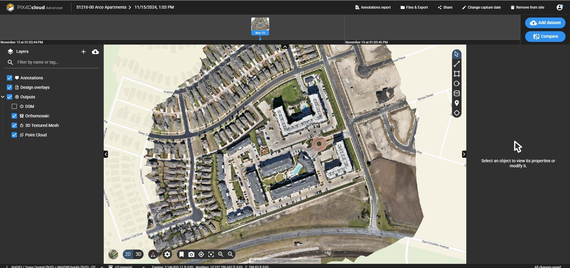
We offer weekly site monitoring for your projects with easy one-click links for on the go OnCloud Deliverables.
Project site monitoring

Volume Calculations

Profile Viewing

Golf Course Maintenance
Plan Views
We can also offer 360° panoramic pictures over your project to give you a Birds Eye view . Click on the images below to see how this works.
360 Panoramics


3D scans
We can host your 3D files for viewing or send them to you. We can send raw .las files or .rcp files for Revit and Civil 3D.


Design your projects with our Photogrammetry contouring data.